Advisories by Twitter and Facebook
Other 2013 Updates
| HOME | DESIGN | BROKERAGE | CREW | NEWS! | F.A.Q.s | BIO | LINKS | EM@IL |
|
|
National Hurricane Center Advisories by Twitter and Facebook Other 2013 Updates |

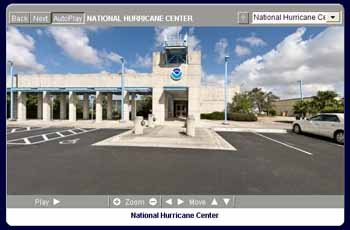
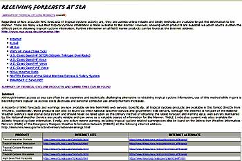
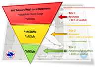
Ed. Note- The National Hurricane Center is offering advisories Twitter and Facebook of daily tropical forecasts for the North Atlantic and Pacific waters in English and Spanish that appear just as they do on the daily updated pages of the NHC site. This service offers the opportunity to receive hurricane advisory communication at a resonable enough cost to be used by any mariner at home and/or at sea. In addition, broadband services of live broadcasts via the internet and other services are being provided for better communication. Special Note: The NHC is no longer offering Email Text Advisories. Alternate text email sources are being offered. See the PDF files and other links below.  Effective for 2013 the National Hurricane Center has daily updates for storm coverage via Twitter and Facebook. New use of the Tropical Cyclone Update (TCU) replaces the Tropical Cyclone Position Estimate. The famous "Cone of Death" has grown smaller. The NHC will broadcast warnings for storms that have extra-tropical status. NHC is planning to extend the time covered by the NHC Tropical Weather Outlook (TWO) from 48 hours to 5 days. Probabilistic storm surge products will be available when a hurricane watch or warning is in effect for any portion of the United States coast. Read more in this Effective for 2013 the National Hurricane Center has daily updates for storm coverage via Twitter and Facebook. New use of the Tropical Cyclone Update (TCU) replaces the Tropical Cyclone Position Estimate. The famous "Cone of Death" has grown smaller. The NHC will broadcast warnings for storms that have extra-tropical status. NHC is planning to extend the time covered by the NHC Tropical Weather Outlook (TWO) from 48 hours to 5 days. Probabilistic storm surge products will be available when a hurricane watch or warning is in effect for any portion of the United States coast. Read more in this  National Hurricane Center PDF file. National Hurricane Center PDF file. National Hurricane Center FaceBook Page National Hurricane Center Twitter Page Live video/audio feed of top-of-the-hour hurricane briefings Alternate Sources for Emailed Text Advisories Links are available to the NHC Virtual Tour to see just where all this storm info comes from and a page titled "Receiving Forecasts at Sea" that provides all the methods for getting marine storm forcasts at sea, an excellent resource for any expedition yacht.
 Effective for 2011 the National Hurricane Center has upgraded Storm Surge forecasting, dropped knots for miles per hour in wind forecasts and updated the famous "Cone of Death" sizing. Read more in this National Hurricane Center PDF file. Go to the the Storm Surge Product Decision Support Wedge page on the NHC site for more Storm Surge information. Effective for 2011 the National Hurricane Center has upgraded Storm Surge forecasting, dropped knots for miles per hour in wind forecasts and updated the famous "Cone of Death" sizing. Read more in this National Hurricane Center PDF file. Go to the the Storm Surge Product Decision Support Wedge page on the NHC site for more Storm Surge information.
In 2010 the National Hurricane Center increased tropical storm and hurricane watch/warning lead times, and made changes to some of its text and graphical products. These changes are part of a continuing effort at the National Hurricane Center to expand and enhance its level of service. Read more in this National Hurricane Center PDF file.There is more access via the NHC web site using RSS/XML feeds, PDAs, Smartphones, Podcast RSS/XML and GIS. See these and details of the new format in hurricane advisories via this PDF file.
|
Please use your back button to return
Back to the Explorer Yacht News
| Broker John DeCaro |
| Fort Lauderdale, FL 33316 USA |
| Telephone: 954-646-1411 |
| info@buyexploreryachts.com |
| HOME | DESIGN | BROKERAGE | CREW | NEWS! | F.A.Q.s | BIO | LINKS | EM@IL |